Island Archaeology
by: Ross Holbrook
“The sense that you are standing in the same spot seeing the same sights as someone hundreds of years earlier links you to your personal past, your heritage.” Dr. Ben Ford, The Shore is a Bridge, The Maritime Cultural Landscape of Lake Ontario.
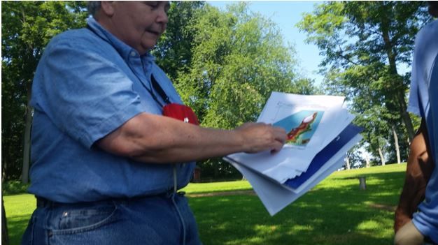
Some years ago, while working to protect the Thousand Islands from uncontrolled industrial development, I was introduced to Ken Knapp, Clayton’s highly-respected avocational archaeologist. We instantly clicked as friends and Ken welcomed me into the fascinating study of North Country Pre-Contact (Pre-European) history and archaeology, a four-generation Knapp family tradition.
Although I possessed a reasonable knowledge of local history passed down from my grandmother and her Clayton contemporaries, my knowledge of local Pre-Contact cultural resources was minimal. Delving into this rich world with Ken, I learned that the Thousand Islands is an important archaeological zone where Indigenous People have lived continuously since the retreat of the glaciers, roughly 12,000 years ago.
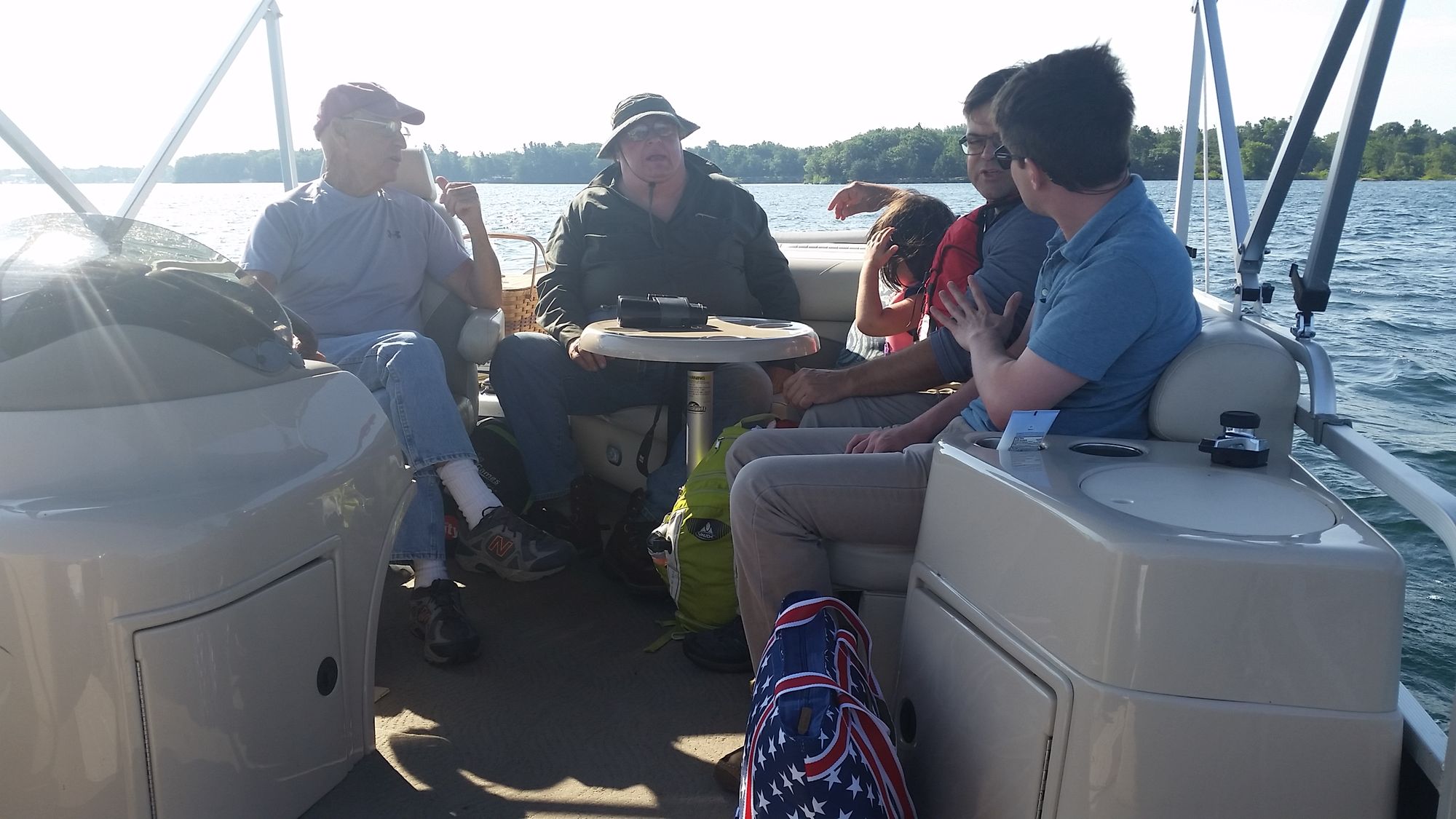
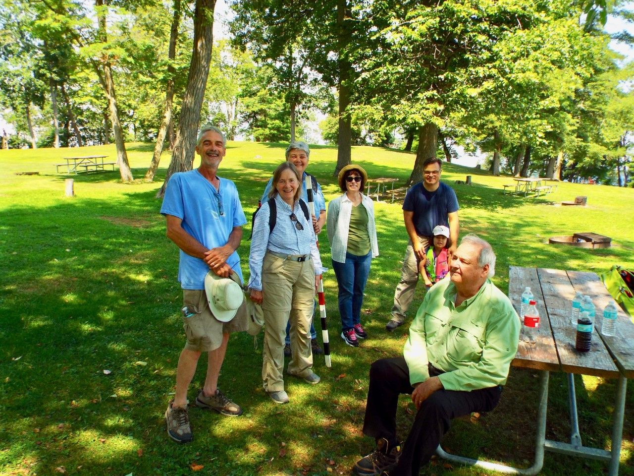
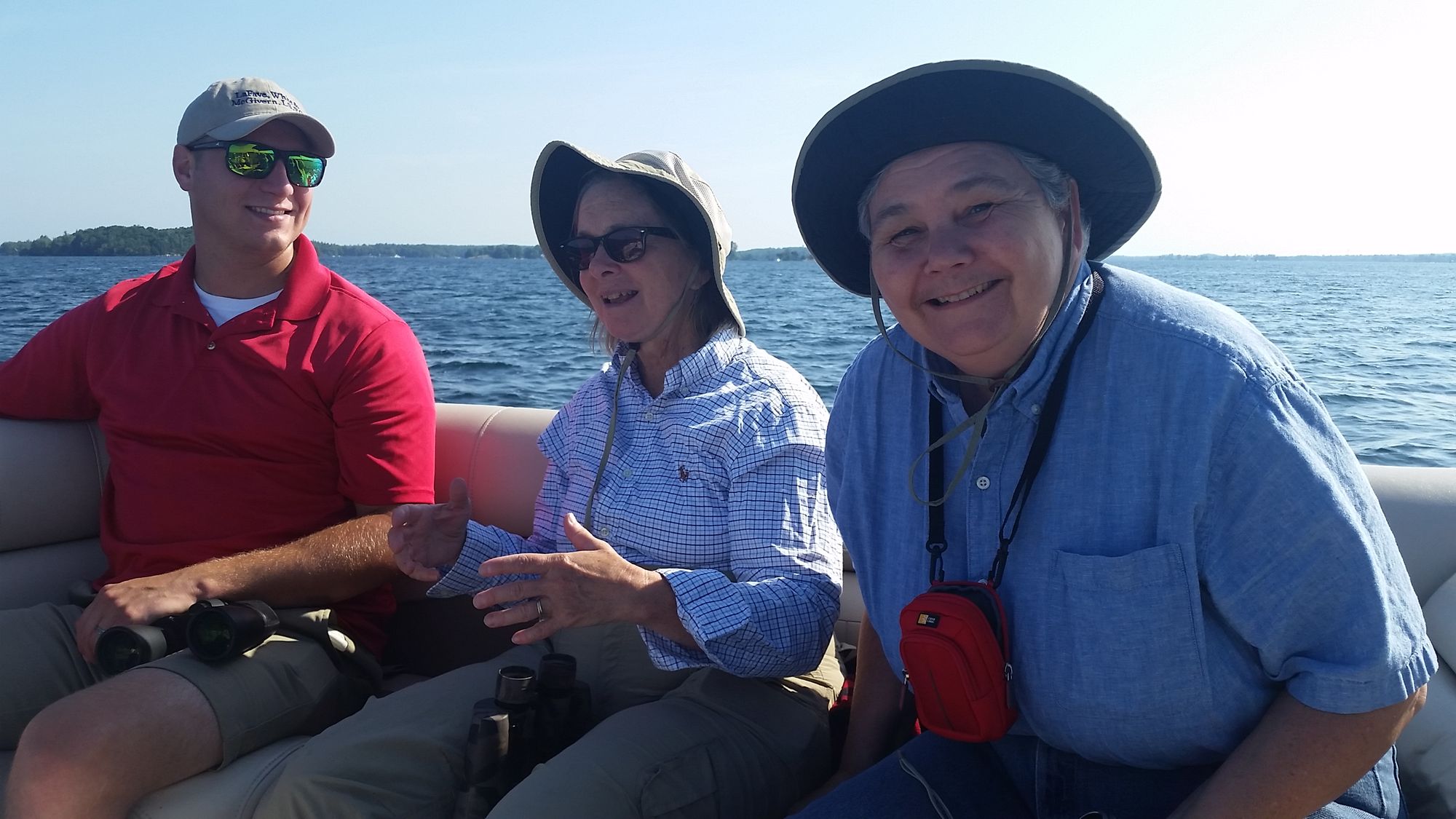
Back in the summer of 2019, Ken decided to organize a boat trip through the islands, inviting a formidable group of archeologists and specialists. More than just a notable gathering of subject matter experts, the boat trip was an opportunity to demonstrate our region’s rich archaeological heritage to archaeologists from New York State Parks, Recreation and Historic Preservation, who were studying, but had never visited, the Thousand Islands. To accomplish this, Ken and I designed a trip to showcase many important archeological sites among the islands, to be visited by means of the water routes likely used by Indigenous People for millennia. To accommodate this sizeable group, the tour was made not by canoe, but rather on Bill Munro’s comfortable pontoon boat, with the ever-affable and highly-experienced Bill serving as helmsman during the eight hour trip.
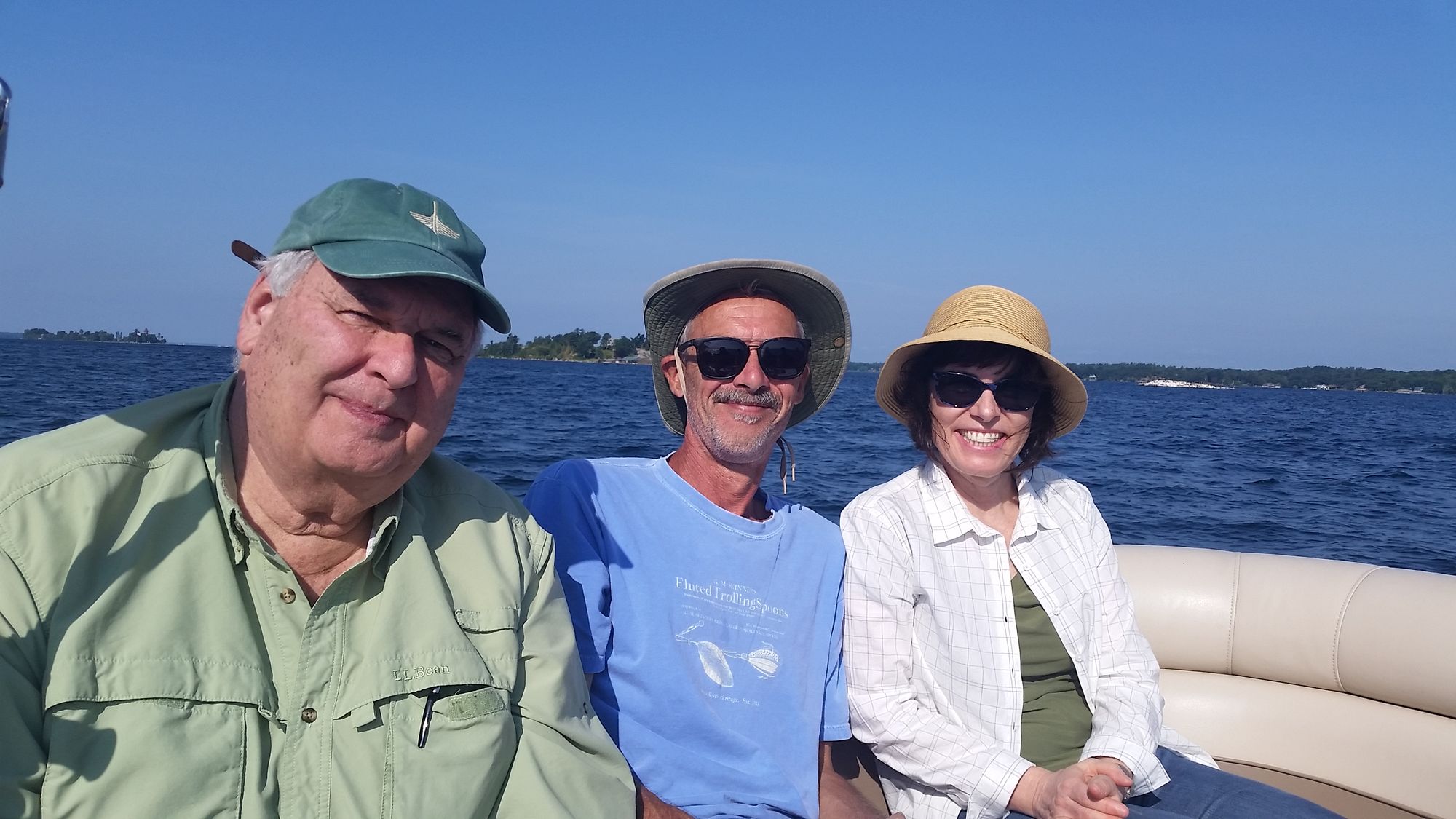
It was a fabulous group to join. In addition to Ken, archaeologist Dr. Laurie Rush had driven over from Fort Drum; Haudenosaunee (Iroquois) specialist Francis Scardera and his young daughter, Ella, had come down from Ottawa; Dr. Julieann Van Nest of the New York State Museum and Dr. Nancy Herter of New York State Parks, Recreation and Historic Preservation had driven in from Albany; and Dr. Bruce Rippeteau, who had first published on New York archaeology in the early 1970s, joined us from Cape Vincent. Adding valuable environmental and landscape perspectives were North Country ornithologist Gerry Smith and Spencer Busler from the Thousand Islands Land Trust (TILT). I played the role of river guide, piloting the routes Ken and I previously identified as the most likely paths of travel used by Indigenous People near Clayton, Gananoque, and the islands in between.
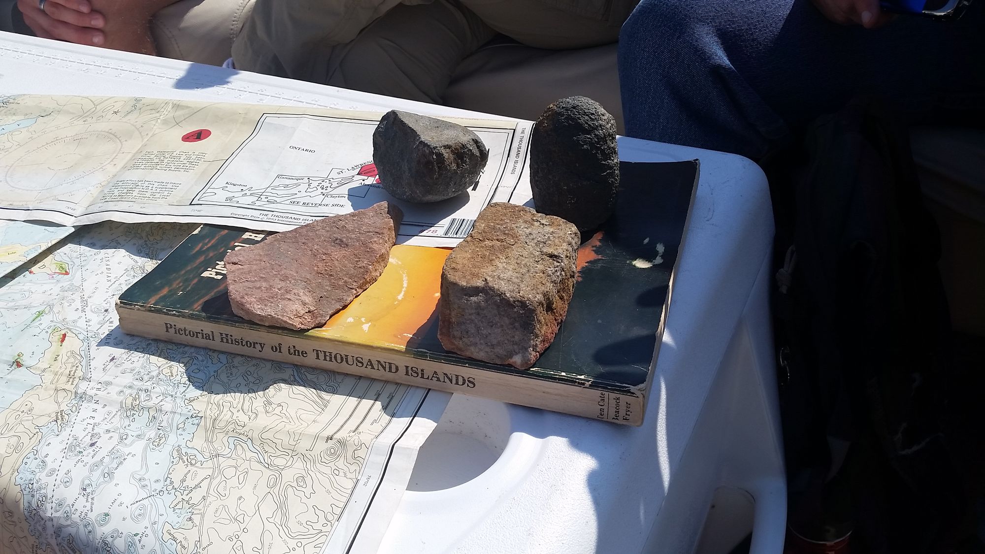
It was a typically beautiful August morning as we assembled at Northern Marine, just a few miles east of Clayton. As we headed out of Spicer Bay, Ken reminded us that a fluted point had been recovered nearby. A fluted point. Heads began to turn. Fluted points had gone out of fashion 12,000 years ago.
With this in mind as we entered the St. Lawrence River – or in Mohawk, Kaniatarowanén:ne, meaning “big river” or “fast moving” – our eyes instinctively found the next connection away from shore, the logical waypoint from here when crossing the River by small craft – Round and Little Round Islands. As we cut between the two, Ken recounted how numerous Paleo-era artifacts, including two additional fluted points, had reportedly been discovered here, laying on a rock outcrop. In about a mile, Ken had shown us two find sites that dated back to the end of the last Ice Age. It was quickly apparent that the trip was turning into something quite special.
With the boat now drifting between Little Round and North Colborne, our next task was to identify the likeliest pathway across the River from this point. While this would have varied given the dramatic water level changes experienced over time, perhaps for the last 5,000 years the logical path, incorporating the variables of distance, current, and wind, is to cut across the channel near Gull Island and then proceed towards the next emergent landmass, Bluff Island, reducing the risks associated with extended travel over deep, often windy, open water. This pathway is the shortest route with the least danger, not to mention the shortest trip time, a potential consideration if unfriendly eyes are nearby.
Arriving off Bluff, it was noted how an intact ceramic vessel had been discovered submerged in the vicinity some years before, suggestive of a cold water storage site or fish pond where provisions could be cached. Also mentioned was the importance of the bluff itself, which would have served as a vantage point and landmark, especially near this important junction of ancient inter-island water routes. After Bill made a quick circle around the island, we cut between Picton, Maple, Murray, and Grenell, and headed towards the American Narrows, where ceramics had been recovered in the past. Passing through the Narrows and entering Eel Bay, it was noted that many of the islands here had produced impressive artifacts, and that Indigenous People, as the name suggests, had fished for eels and other food sources just as 17th century Jesuits had observed ten miles further downriver at the famous Haudenosaunee village of Toniata.
Ken reminded our party how both during the Lake Lowstand (roughly 9,000 years ago when Lake Ontario was at its lowest and effectively disconnected from the River) and in more recent times before the completion of the Seaway, lower water levels would have turned Eel Bay into even more of a bathtub than it is today; an ideal, expansive, flat, spawning ground teeming with important resources. Laurie Rush, who has studied the archaeology of the region professionally for decades, took the opportunity to mention how Haudenosaunee families would still return well into the 20th century to summer at traditional spots along this shoreline, and how others like it have been passed down from Indigenous People to fishing guides, in a chain of knowledge that still exists today.
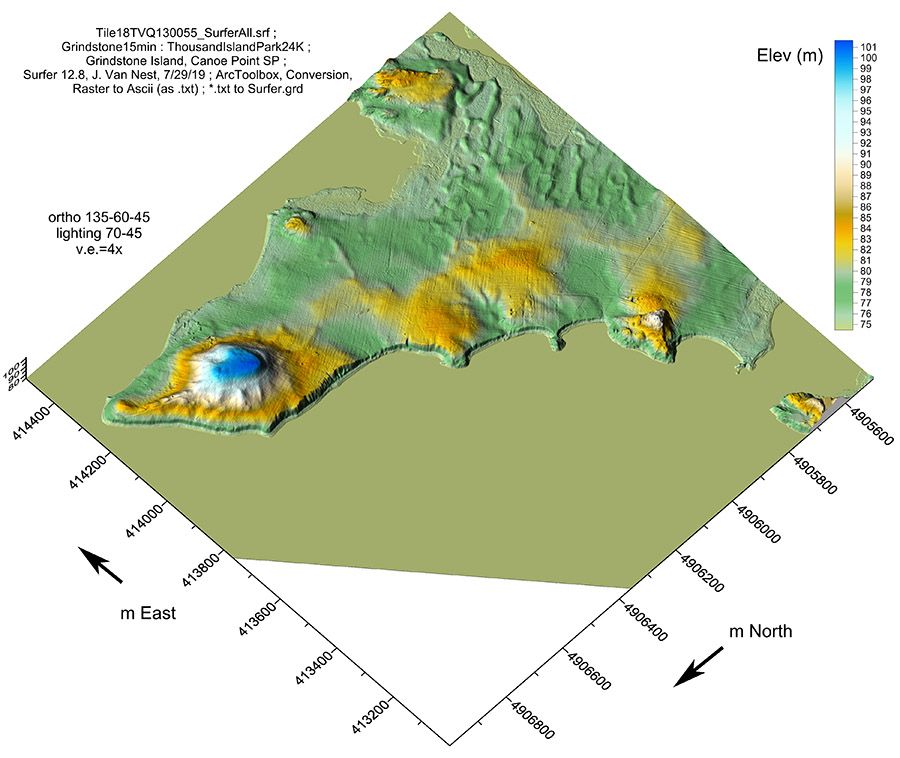
After all morning on the River, we made the short trip to Canoe Point, a crown jewel in the New York State Parks System that we were eager to show our visitors from Albany. Here it was explained that the site, and much of the rest of the foot of Grindstone, consistently produces evidence of Indigenous occupation. Lunch was served at a picnic table below the promontory on the point that boaters use as a landmark, a hill that actually contains a substantial mortuary complex and campsite, where important Point Peninsula type artefacts dating from nearly 2000 years ago were recorded by excavators in the mid-20th century.
Over lunch, geoarchaeologist Julieann Van Nest took the opportunity to showcase some of her ongoing research into the geomorphology of this site, suggesting the possibility of large-scale landscape modifications and the likelihood of the promontory functioning as an important ceremonial center before European contact. To these profound observations, Bruce Rippeteau recounted a favorite anecdote of how former state archaeologist Dr. William Ritchie, while visiting the site decades ago, once leapt to his feet in surprise, having poked a hole in his trousers after inadvertently sitting on an exposed arrowhead right at the foot of the island.
Leaving this ancient spot and heading around Grindstone, it was not hard to understand the importance of this place. Located at a major intersection of ancient travel, one would have seen boats from the more ancient of common routes through the Thousand Islands: not the American Main Channel as today, but rather the winding, island-hopping route along the Canadian shoreline that was used for millennia by Indigenous People and the early Europeans who followed.
Now headed into the patchwork of islands between Grindstone and Gananoque, Francis Scardera, who has worked with the Mohawk of Akwesasne for many years, resumed his explanation of how further downriver nearly all islands have yielded some degree of Pre-Contact cultural resources, a point added to by Dr. Rush, who noted how current plant and tree species can be indicative of prior indigenous settlement.
The next couple of hours were spent exploring more proposed inter-island routes, while also approaching rock faces and overhangs to the closest extent possible to search for rock art. Complemented by Spencer pointing out parcels protected by TILT and Gerry Smith’s insightful observations on flora and fauna, lively conversation and archaeological theory flowed, not from behind desks or computer screens, but here amongst the islands, where Indigenous People have lived continuously, in greater or smaller numbers, for upwards of 400 generations.
By late afternoon, the wind had woken up and a steady chop met our bow as we headed upriver. A quick glance at the horizon indicated an approaching thunderstorm blowing towards us from Lake Ontario, in or Mohawk, Kaniatarí:io, “nice lake”. Instead of pushing into the impending storm and continuing around the exposed head of Grindstone, we decided to swing back around Canoe Point and opt for the least exposed, leeward routes back to Spicer Bay. After a day spent in the mindsight of earlier travelers, it was a special moment, as we recognized how the decision we had just made, and the route by which we were returning, likely would have mirrored that of Indigenous People travelling the same waters thousands of years ago.
Are you interested?
Stepping onto the dock and back into the present, we were all buzzing with new thoughts, research questions, and plans of future gatherings of this informal research group. Whether back on the River or exploring the many sites on the mainland nearby, possibilities for future study are endless, especially as we hope to include more perspective and participation from Canadian specialists. With cross-border travel now possible, I know that Ken is busy planning a follow-up trip.
Perhaps you have a family story, a piece of pottery, or a broken arrowhead pulled from your shoreline or field. In archaeology, simply knowing about things adds a new piece, helping to unravel the past. If you think you may have something to add to this evolving understanding, or would simply like to learn more or get involved (and not all research involves a boat) I know that Ken would love to hear from you at kknapp62@yahoo.com.
By Ross Holbrook
Ross Holbrook has been fortunate to spend every summer in Clayton with his grandmother and extended family, and feels deeply connected to the Thousand Islands, its people, landscape, and history. He returns to the River frequently when not engaged in professional activities, which include sustainability/natural resources and art & antiques consulting, sales and brokerage.