The Making of "Drain the American Revolution" on Carleton Island and Cape Vincent
by: Kathi and Dennis McCarthy
On Tuesday, June 2nd, 2020, National Geographic released the TV program “Drain The American Revolution”. This show uses Computer Graphics (CG) to tell the story of shipwrecks in three different parts of the United States and their impact on the American Revolution.

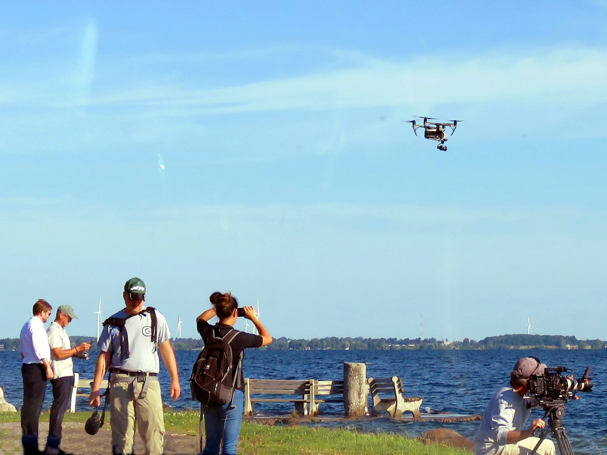
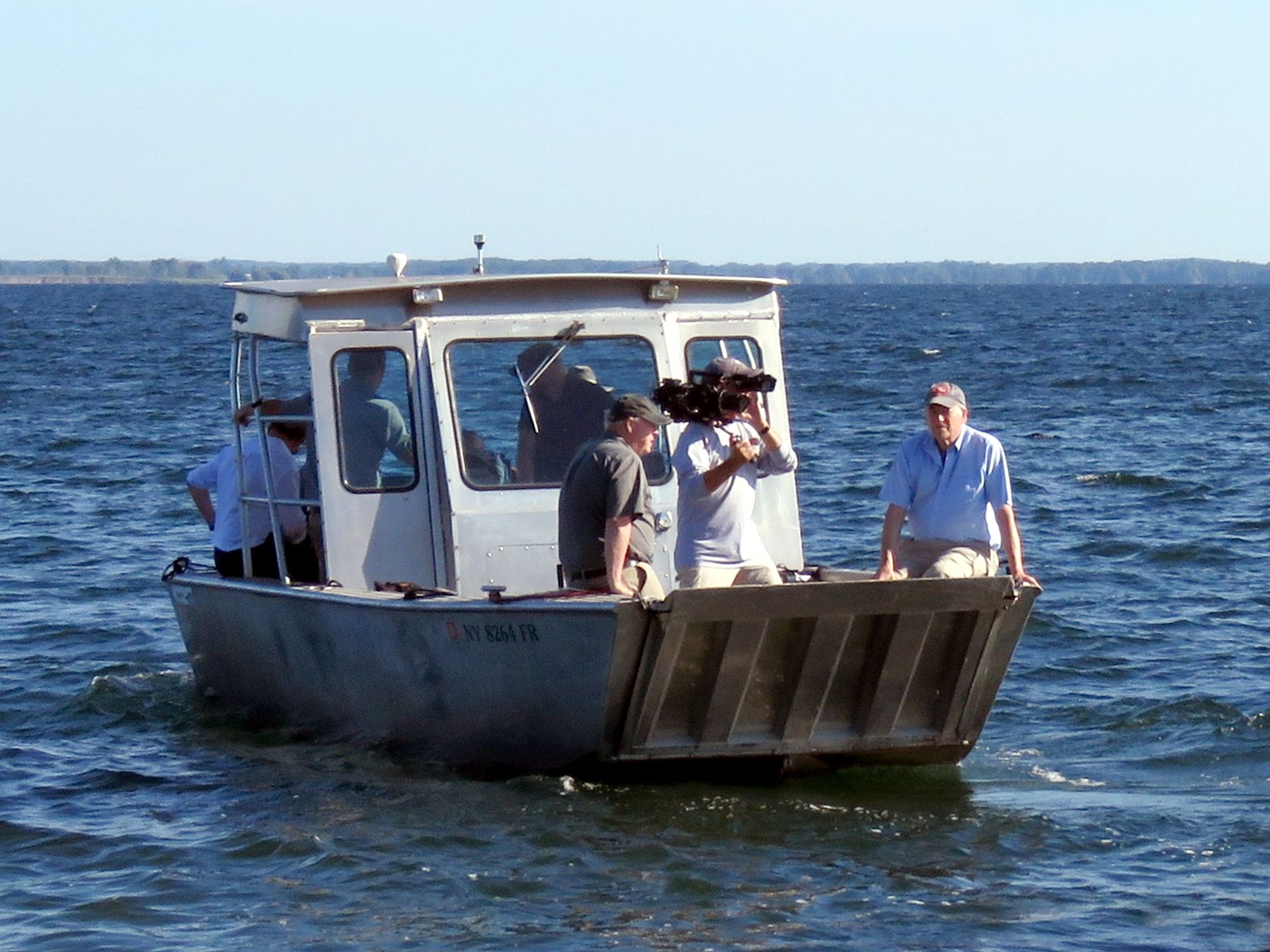
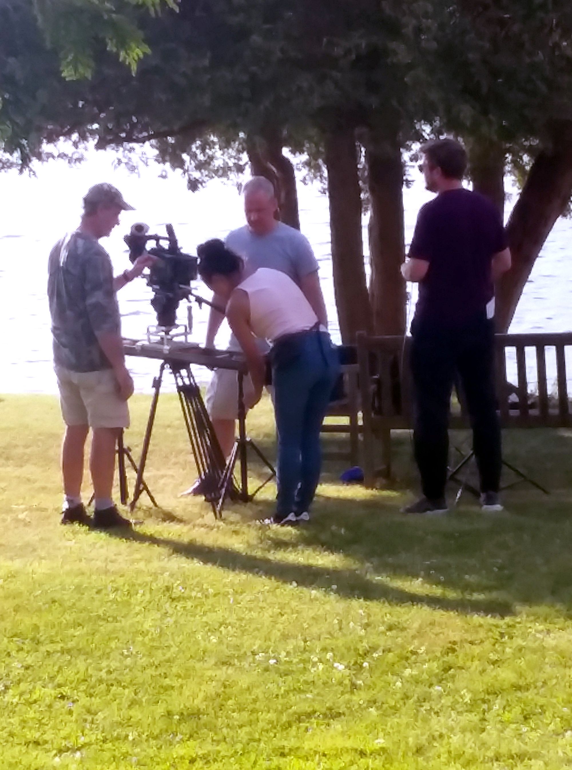
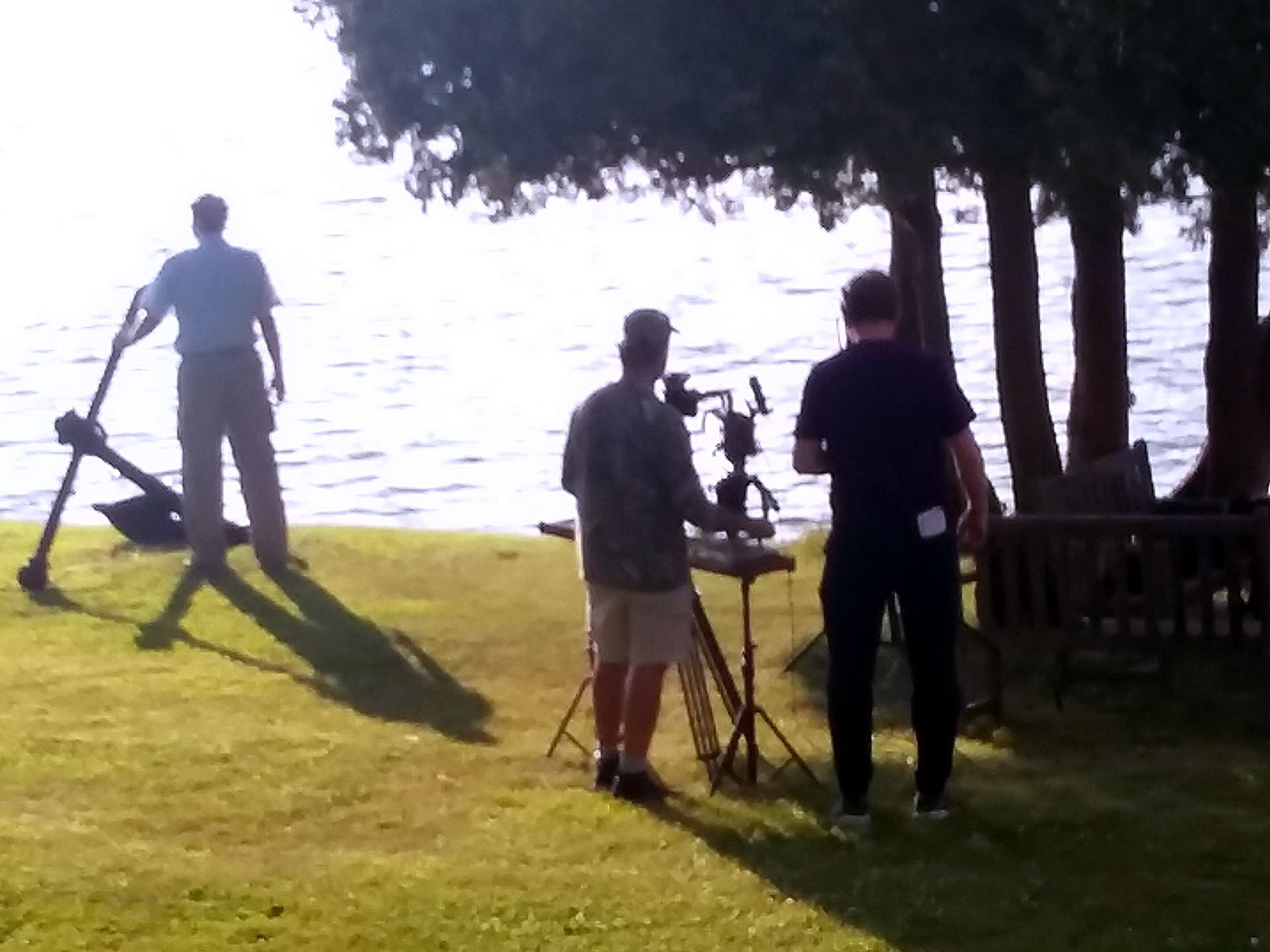
Sam Taplin, Producer and Director for Mallinson Sadler Productions contacted us after reviewing information on www.forthaldimand.com web site back in May 2019. The production company was making a documentary last summer for National Geographic's series 'Drain the Oceans' and was looking for help in making arrangements to film sections for this program on location in Cape Vincent and on Carleton Island in mid-July 2019.
Why was National Geographic interested in filming on Carleton Island, in Cape Vincent, NY?
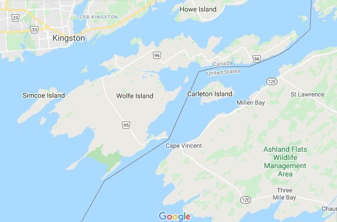
Today, Carleton Island has no great political importance to either the United States or Canada. However, the situation was very different back in the 1700s. Both modern countries were original colonies of Britain. Carleton Island occupied a strategic point between the Thirteen Colonies that declared their independence in 1776, and the loyal British Colony of Canada. Carleton Island was to play an important role during the War of Independence.
The Past
In August 1778, England's Governor-General of Canada, Frederick Haldimand, instructed Lt., William Twiss of the Royal Corps of Engineers, to select a site at the Eastern end of Lake Ontario for the Royal Dockyards and Navy base. John Schank of the British Royal Navy assisted Twiss.
After reviewing both the abandoned French fort at Cataraqui (Kingston, Ontario) and and island close by called, Deer Island, Twiss and Schank selected the Island. Twiss renamed the island Carleton after Major General Sir Guy Carleton, the governor of Quebec. Twiss outlined the design of the docks, shipways, hospital, fortifications, and barracks.
After designing the major earthworks known as Fort Haldimand, Twiss returned to Quebec City, leaving men from the Royal Corps of Engineers to oversee the construction.
The shipyard built two major vessels as well as several gunboats and maintained the Lake Ontario fleet.
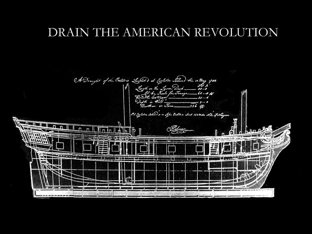
The HMS Ontario was one of the major vessels built at Carleton Island and launched in 1780. The Ontario sank in a storm in Lake Ontario on October 31, that same year. She was a 22-gun "snow"(1) and, at 80 feet in length, the largest British warship on the Great Lakes at the time.
The Ontario was commissioned to replace the aging HMS Haldimand, a snow rigged warship built at what is present-day Ogdensburg NY, in 1771. On Oct 13, 1778, James Andrews was appointed Master and Commander of the Naval Armament on the Rivers and Lakes. His ship on Lake Ontario had been the Haldimand. But in the spring of 1780, he took command of Ontario, but neither the Captain nor the ship remained on Lake Ontario for long, as they sank that same year and the captain went down with his ship. Three years later, in 1783, the Haldimand was decommissioned and her remains are still on the bottom of Carleton Island’s North Bay.
The Present
In June 2008, Jim Kennard, a diver from Rochester, NY announced that he and his team of shipwreck hunters had, after years of searching, discovered the remains of HMS Ontario using sophisticated side scan sonar and an underwater remote operated vehicle in deep water off the southern shore of Lake Ontario.
Today, Fort Haldimand on Carleton Island, is owned by the Thousand Islands Land Trust, and they offered Sam Taplin’s team permission to film on Carleton Island in view of where the ship, Ontario, was built at the dockyards adjacent to the British Fort. Then, the filmmakers moved to Cape Vincent Museum, where they photographed Jim Kennard in the Museum as he discussed the building and the sinking of the Ontario.
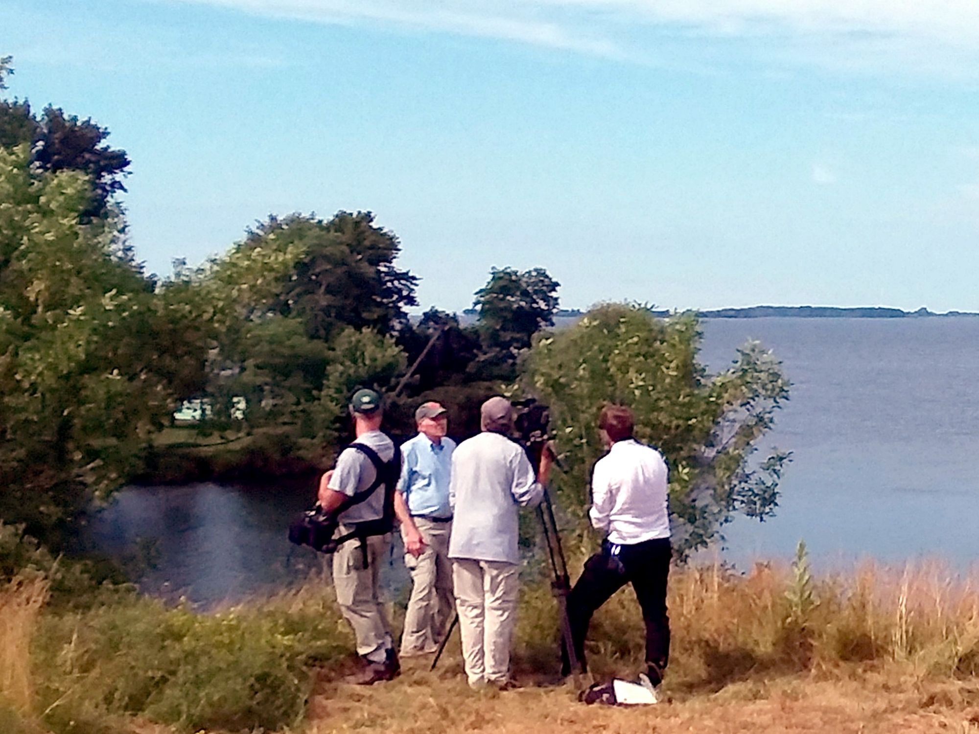
Although they filmed for two days in Cape Vincent, the majority of the footage was cut as the producer and director, Sam Taplin, had packed several years and too many shipwrecks into a 47-minute program. Relying heavily on sophisticated computer graphics, National Geographic primarily tells the story of the discovery of shipwrecks involved in the American Revolution. Light on historical facts, the viewer is compensated by showing the ships as they where when they sailed and as they are now on the bottom of the waters.
Past and Present on Film
But for those of us fascinated by stories behind the many ships now lying on the bottom of Lake Ontario and the St. Lawrence River, this project provides an important view to the area's history.
The digital reconstruction of the HMS Ontario shows in detail the first ship built in Cape Vincent and Jefferson County. At the time it was a world-class vessel. Shipwrights and supplies were brought up from Montreal, past our Thousand Islands, then known as Les Milles Iles, via what is now the St Lawrence Seaway to a very isolated post at Carleton Island. Rigged as a snow, the Ontario was built to standard for British naval ships on the ocean and ill-prepared for the unpredictable waters of the Great Lakes... and she sunk!
You can see the whole film on IMDB: https://www.imdb.com/title/tt12440636/
(1) "Snow" described by wiktionary, "A square-rigged vessel, differing from a brig only in that she has a trysail mast close abaft the mainmast, on which a large trysail is hoisted."
Thumbprint photograph: Original Admiralty draught of the Ontario from 1780, British Library.
By Kathi and Dennis McCarthy, Beadles Point, Cape Vincent
Kathi and Dennis McCarthy are active members of the Thousand islands diving community and are the owners of Blue Ledge System Inc. which published five books, relating to diving and/or the history of the Thousand Islands. To see a TI Life profile of this very industrious couple, please see our March 2011 article, Kathi and Dennis McCarthy’s Discoveries … Also see Dennis' articles written for TI Life here (prior to June 2018) and here (after June 2018).