Giving Chase: Shipwatching on the St. Lawrence
by: Craig I. Stevenson
“The Front” is a term harkening back to a time when the St. Lawrence River served as a vital transportation route connecting communities from Kingston down to Montreal.
The space where water and land met—at “The Front”—was a hinge between community and commerce from the early periods of aboriginal history through to the region’s settlement by United Empire Loyalists and the establishment of agriculture and industry along the St. Lawrence.
The River is now, of course, the St. Lawrence Seaway—a waterway designed as a commercial link between the Atlantic Ocean and the continental interior. It has performed as such since its opening in 1959.
Much of the maritime character of the old River was lost with the flooding that accompanied the Seaway project. Canals, locks, ferries, and customs offices disappeared from the waterfront. But the ships remained as a constant on the River—and they continue to stir the imagination.
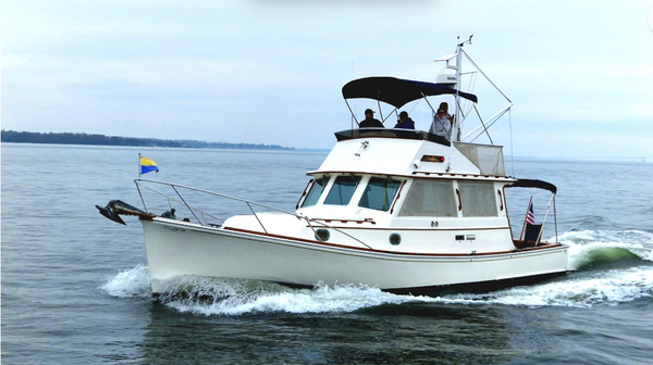
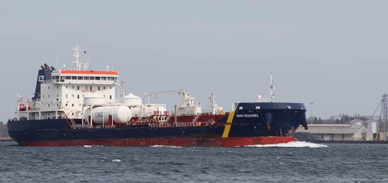
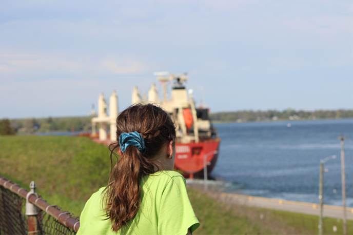
Modern commercial traffic on the Seaway gives a new twist to the idea of the River as a unifying geographical feature. The ships themselves have become a commodity shared and consumed by a social media audience to create a unique form of community bond along the River.
Ships interest people for various reasons. There are those drawn to their technical features, or their economic role, or in the cargoes they carry. Some are attracted to the ships’ differing designs or have made a personal connection to specific vessels. Others are thrilled by the blast of the horn to salute onlookers, or by the thought of where an overseas “salty” has been and where it is going.
The Canadian shoreline from Brockville downriver to Morrisburg offers a selection of vantage points from which to watch, photograph, and simply marvel at the Seaway’s shipping traffic. All are accessed easily via Highway 2 as it parallels the shoreline.
For the road-bound explorer, here are three locations where one can see these giant craft from distinctly different perspectives.
Prescott
The ships move with a slow, insistent grace, and the narrow width of the St. Lawrence at the town of Prescott offers an excellent perspective on the vessels in motion. For panoramic perspective, the pocket-sized park at Kelley’s Bay lets the observer see the ships in transit against a backdrop with a maritime feel.
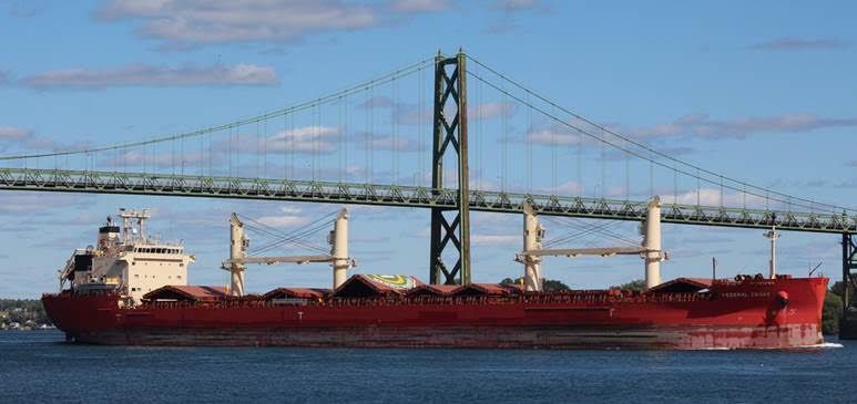
The better view at Kelley’s Bay is to the east, looking down the River. That perspective extends to the Ogdensburg-Prescott international bridge, and encompasses a pair of historic lighthouses: the wooden lighthouse at the entrance to Prescott’s marina and the stone Windmill lighthouse further east at New Wexford. The historic Ogdensburg lighthouse and the Port of Ogdensburg add cross-river detail to the scene.
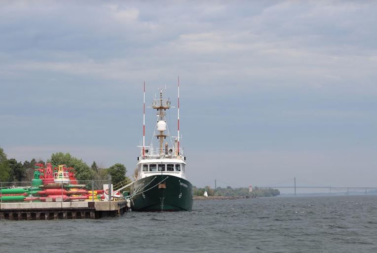
Close at hand on the north shore is a Canadian Coast Guard base, the home port of the ice-breaker Griffon. Stacked buoys on the base dock are evidence of the ice-breaker’s role in maintaining navigational aids along the Seaway.
These elements create a scene mildly reminiscent of the seaside, and complement passing ships nicely. That character is not at all contrived. Prescott has a long history with commercial shipping dating to its period as a point of trans-shipment or “forwarding” freight around the sections of rapids downstream. That role disappeared long ago but the feel can at least be summoned with a bit of imagination.
Prescott offers an abundance of opportunities to the ship watcher. Slightly east of Kelley’s Bay a person might also take up station on the open expanse of shoreline park and trail in front of Fort Wellington. The space was formerly a rail yard for the Canadian Pacific Railway, and the weathered timbers along the shore are the remnants of a docking facility where rail commerce was ferried across to Ogdensburg. They are now but an interesting accent to a broadside view of ships as they pass between the towns.
The Port of Johnstown
A short distance east of Prescott, the River’s commercial character emerges in remarkably plain sight. For hours—in some cases, days—ships at the Port of Johnstown sit immobile as their holds are filled or emptied.
This scene characterizes the working River and there is nothing “pretty” about it, in the conventional sense. It is all diesel rumble and whining pulleys, grain dust in the air, hillocks of salt, and dockside cargo. Rail spurs and a parade of heavy trucks add to the industrial imagery.
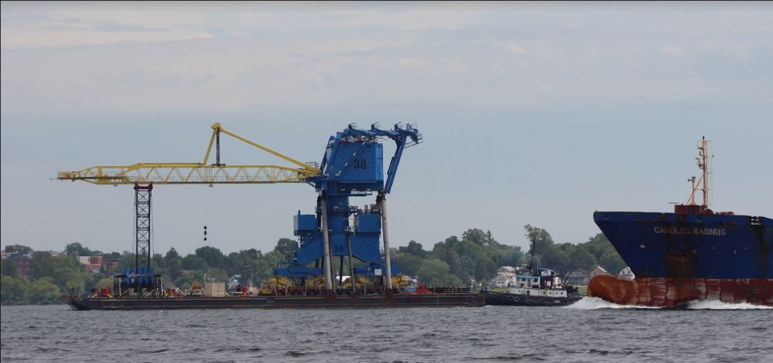
Here, the region’s global economic connections are within easy view. Salt, steel rails, and wind turbine sections are unloaded dockside, and the autumn harvest of corn and soybeans is loaded by chutes, which drop from the massive grain elevator that looms over the site.
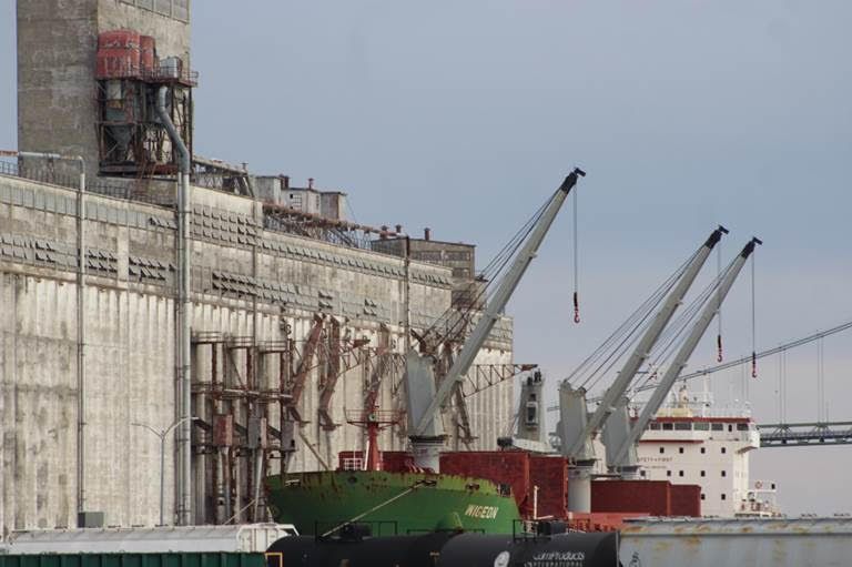
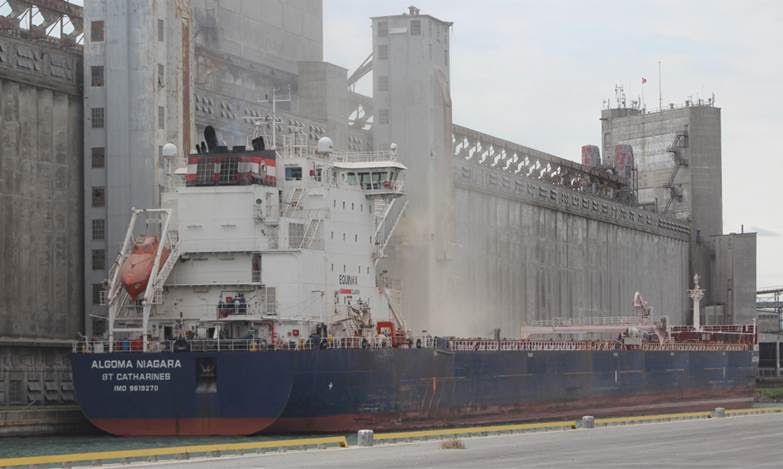
The elevator is one of a very few structures whose bulk matches that of the ships. Completed in 1931, its silos, belts, and spouts are marvels of an earlier industrial age, and present themselves in rumbling mechanical defiance to the digital age with the simple premise that the system works quite well.
The elevator should sit firmly within the pantheon of Canadian architectural history. It has served this country’s resource-export economy since the pre-Seaway era of small canal ships and river rapids, and it has adapted to the larger scale of Seaway shipping in loading domestic lakers and ships bound for international destinations.
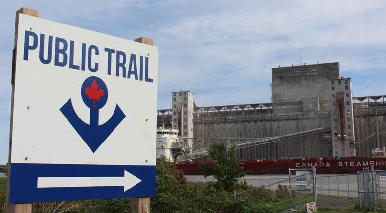
That historic character only adds to an excellent view of the operational side of Seaway shipping. The municipal walkway and pier, at the east side of the port complex, provide a view of ships docked on the east side of the elevator, as well as a closer-than-shoreline view of ships passing beneath the adjacent Ogdensburg-Prescott international bridge.
Iroquois
Twenty kilometers downriver from Johnstown, Iroquois is an essential stop for the ship watcher. It is a place where the River’s shipping past feels remarkably close to the present, and offers an unequalled view of the ships traversing the system.
Iroquois embodies the Seaway’s character and the immense change it wrought along the Canadian shoreline. Its original site was leveled by the project and the town moved to the north, and a control dam and shipping lock were constructed adjacent to the town. The new lock cut through the protrusion of Iroquois Point, a place of various histories ranging from ancient aboriginal encampments to summer residences, apple orchards, and a cemetery dating back to the community’s 18th century origins.
The lock’s design incorporated an elevated visitors’ space into the site that allows viewers to see ships at close range, and at a standstill. In the few minutes that it takes a ship to transit the lock, spectators see the workings of a ship in almost documentary fashion: deck hands winching mooring lines, hatches being sprayed with cooling water to prevent hull buckling on hot days, the turbulent wash of bow thrusters and propeller as these machines move through a lock chamber with little room to spare. Add to that the operation details of the lock: rising and falling cable arrestors, sector gates swinging to open and close the chamber, the alarm of the bascule bridge as it is raised, and an array of cranes and stoplog beams and spare arrestors alongside the chamber.
The longer downriver view provides an elevated panorama, taking in the Iroquois control dam as it stretches to the American shore and the sweeping hook of the River’s flow away to the east. A “meet” of two ships below the lock—as one exits downriver and a second waits for it to pass before moving up along the lower approach wall and into the chamber—shows how nimble these craft must be to navigate safely within the fast-flowing channel.
The ships’ rise and fall through the lock is usually minor and indiscernible to the viewer. It is, however, a remarkable view of the process that all ships must follow as they overcome a difference in water level of approximately 170 feet between the upriver side at Iroquois and the downriver water level at Montreal.
Nearby remnants of the pre-Seaway lock and canal offer a more subtle view of the ships from a perspective that highlights the historical contrasts here. Located along the road into the modern lock is a municipal marina on the site of what was once the lower end of the Galop canal system, with the chamber of the old Iroquois lock very much intact. Its stone blocks and bollards and the weathered lockmaster’s hut date back to the early twentieth century and that period when shipping on the river was a more intimate affair of old “canallers”, which were a third of the length of today’s ships.
At the edge the marina basin, a memorial bench to former lockmaster, Howard Edison Fawcett, offers a seat from which one can see both sides of the historical divide. The contrast of the pre-Seaway lock in the foreground and the modern dam and shipping channel in the background, remind us that the river here is characterized by the heavy hand of change and “progress.” That reality still sits uneasily within local memory.
A Road Ahead
Ship watching defies categorization. It can be enjoyed exactly as a person chooses, ranging anywhere from casual observation to dedicated pursuit. The locations described above are only three of many available. With the road before them, enthusiasts can give chase along the river and find their own preferred spots to wait and watch.
Can it be more than this?
Currently, ship watching flourishes as a general interest within the realm of social media, and the venue it presents for sharing information and photographs. Whether it should evolve beyond its current informal and spontaneous character is a matter at least worth considering.
Riverside communities might benefit from an effort to raise interest in ship watching by giving the activity organized and local focus. Doing so would restore a bit of the character lost after the construction of the Seaway. At least symbolically, celebrating the ships would bring these towns closer to the waterway, so elemental to their history and identity.
How we choose to see the ships is an interesting question that will play out in time, independent of the seasons that dictate their passage up and down the St. Lawrence. That season will soon end and be succeeded by another, in a cycle carefully watched and anticipated by enthusiasts who appreciate the river from a particular—but particularly important—perspective.
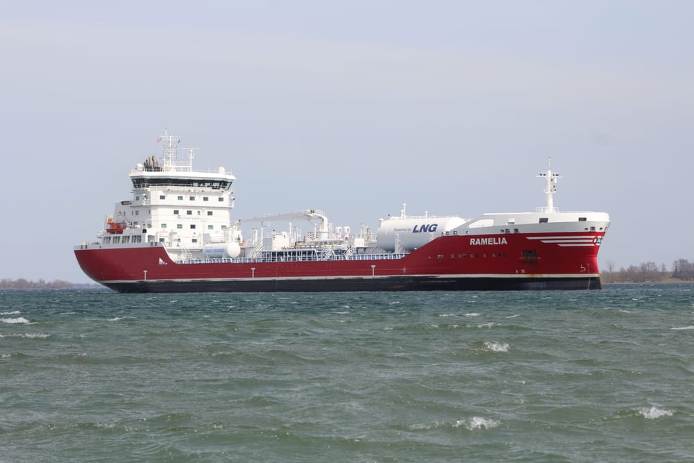
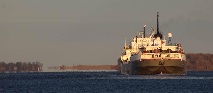
[Header photograph: The tanker Ramelia slowly moving toward the lower approach wall of the Iroquois Lock on a brisk spring day. Note the colour difference in the water between the ship and the shoreline. The line separating the darker blue water from the olive-green water is the river’s shoreline before the Seaway project flooded the area. April 11, 2021.]
By Craig I. Stevenson
Craig Irwin Stevenson grew up in Cornwall, Ontario, and spent an inordinate amount of time on and along the River, at his maternal grandparents’ cottage, on Moulinette Island, the easternmost of seventeen islands created by the Seaway flooding. He is a history teacher at Tagwi Secondary School, in Avonmore, Ontario, and never misses a chance to tell his students that the River they see today, was once a very different place.
Be sure to see Craig Stevenson's other River stories here.
Editor's note: For those interested in Shipwatching, be sure to check out this list of websites provided by the author.
St. Lawrence Ship Watchers Facebook: 40.5K members
Boat nerds of Facebook: 16.4K members
The Prescott Anchor: 7.5K Members
Ship Junkies - Lakes, Locks & Rivers (LL&R) 7.3K Members
And be sure to read Ship! by Lynn McElfresh "SHIP! It’s a game we started when my husband retired nine years ago. . .