About Mary Island...
by: Linda Twichell
Have you ever wondered about Mary Island and the canal that separates it from Wellesley Island? The is so much to say about this area. Did you know that this island was once part of Westminster Park?
First of all, let’s be clear: the island is named Mary Island. I confess I have always called it “Mary’s Island”. I am working on overcoming that error, but old habits die hard. Moreover, this twelve-and-a-half-acre island was also once known as “Picnic Island”. Can we explain the name confusion? The founders of Westminster Park knick-named this area “Picnic Island”. One guess is that they wanted to create the idea that hotel guests might venture to this location for a picnic in the woods. There are reports that the Hotel would furnish a picnic lunch and a buggy ride to the end of the island for this purpose. However, even in early Westminster Park documents, we see the name of the island is Mary. Deeds recorded in April 1879, reveal that the Westminster Park Association purchased this land from Horatio Nelson Throop and his wife, Mary L. (Mary F. Ledyard). One might suppose the island name was to honor her. To add to the confusion, on the very same Westminster Park document from 1879, we see in the text a description of Mary Island. On the reverse side, we see the map labeling the island as Picnic Island. Is there any wonder why confusion reigns?
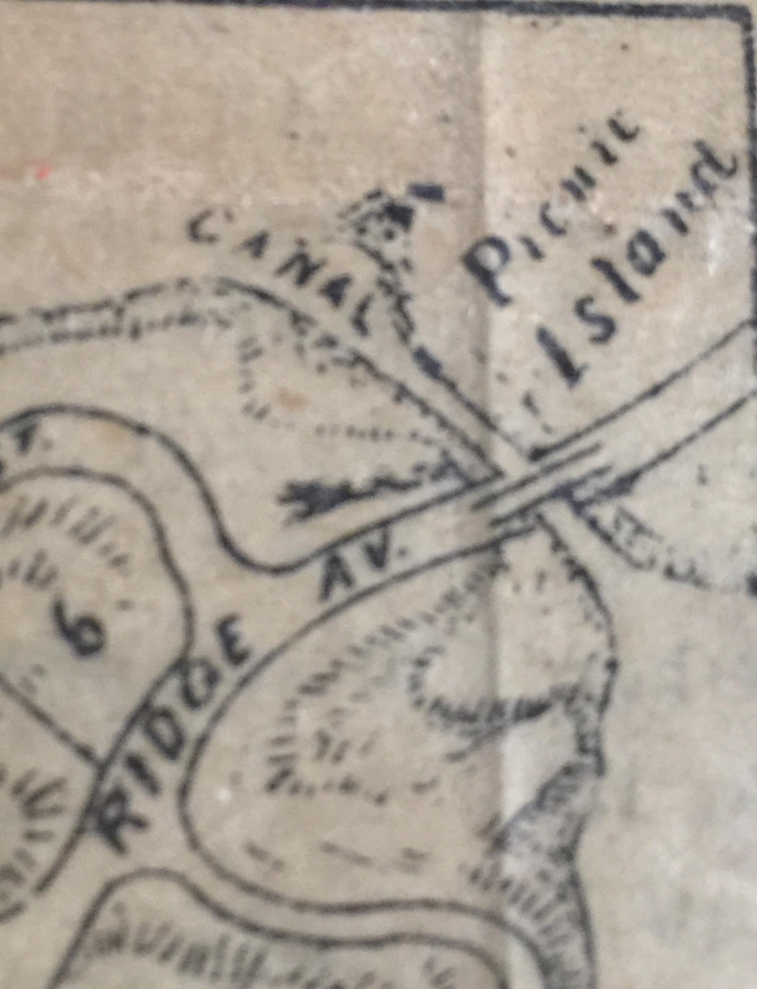
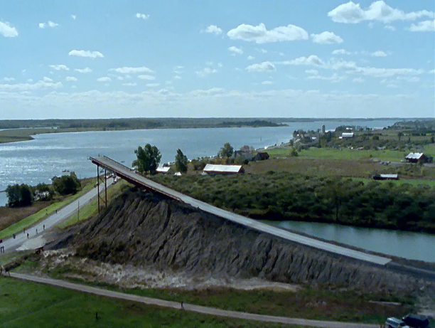
Today we clearly see an island, separated from the foot of Wellesley Island by a small canal. Was that always so? Some old reports refer to that canal as an “artificial canal,” designed to provide fishing guides with a short-cut to avoid rowing around the end of Mary Island. Some will point to early maps, which do not show a canal. I think this is a map error, since this same map shows the development of Westminster Park. The original documents from the Association mention a canal and an island. The 1878 map, drawn by Engineer Frank Hinds of Watertown, shows the canal and a bridge.
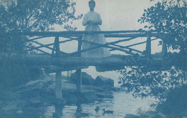
Was there ever a bridge across this small canal? How would fishing guides fit their skiffs under such a bridge? To date, I have not found any definitive data on a small bridge in that location, but I did find this image that had no label. I wonder if that might be the bridge in question. What do you think?
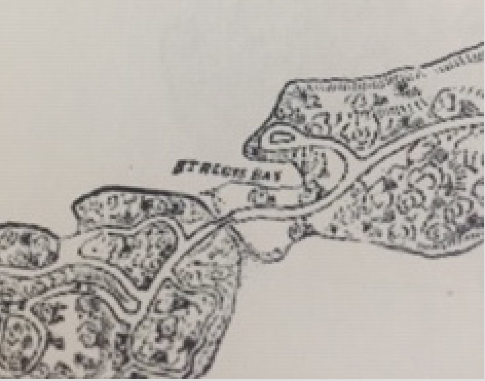
And speaking of maps, here’s an “oldie” that labels the small bay just downriver from the canal as “Saint Regis Bay.”
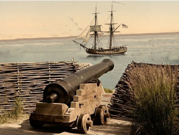
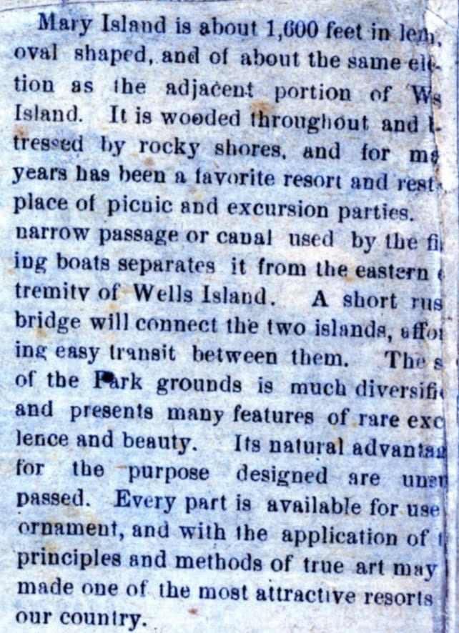
In 1879, Andrew Boyd published a pamphlet, shared with me by noted River Historian Robert Matthews. It was entitled “Hand-book and Picturesque Guide Among the Thousand Islands and River St. Lawrence”. Boyd detailed descriptions of many vacation, sites from Newport to Toronto. Regarding Mary Island, he describes the physical features and Boyd notes that even in 1879, it had been for many years “a favorite resort and resting place of picnic and excursion parties.” He continues with, “A narrow passage or canal, used by the fishing boats, separates it from the eastern extremity of Wells Island. A short rustic bridge will connect the two islands, affording easy transit between them.”
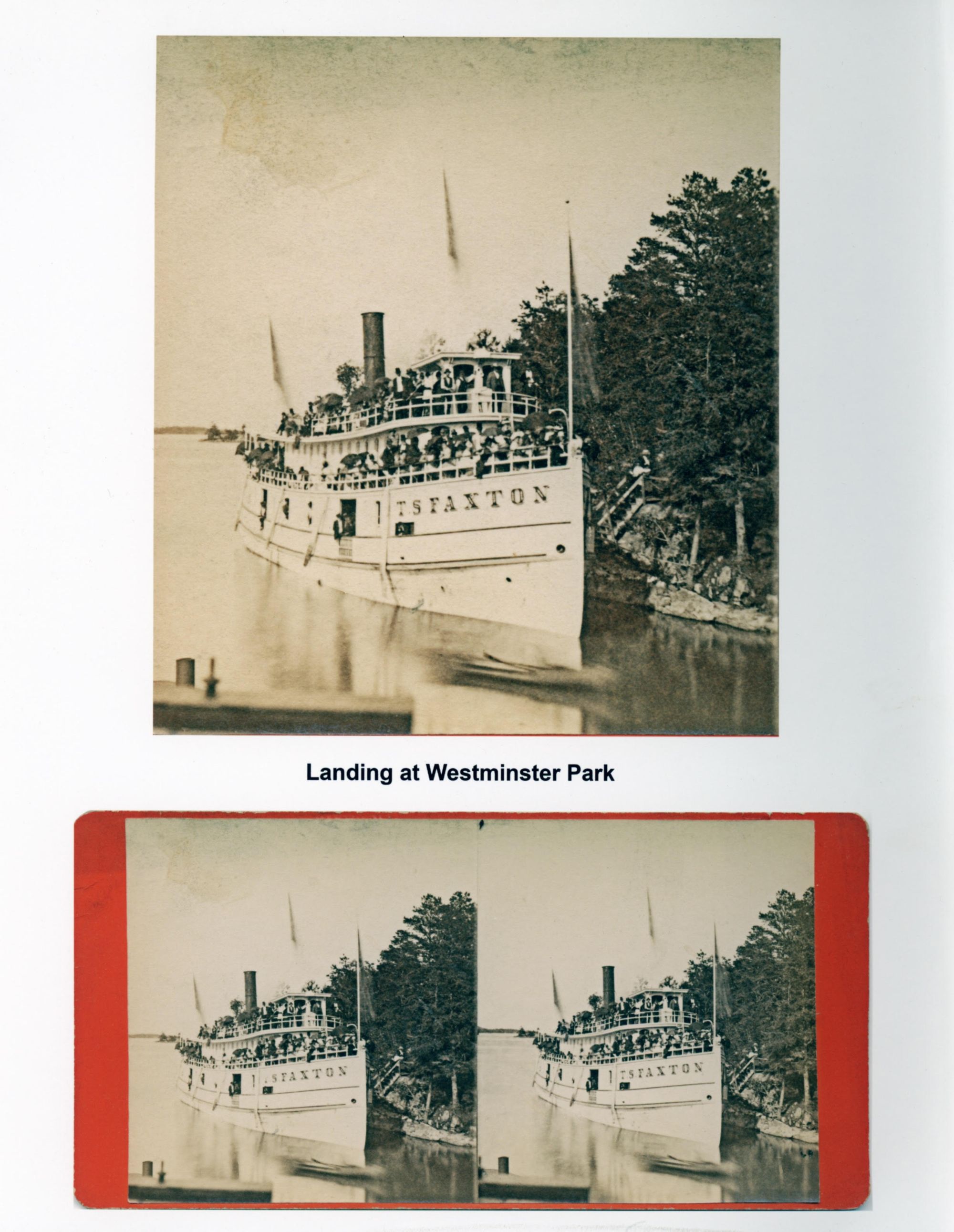
Before the development of Westminster Park, excursions landed on Picnic Island. In a report from 1877, we read that Andrew Cornwall brought a party of 500 people, from the Stone Church of Watertown, aboard the steamship “Faxton". It was reported, “A new landing, with a short flight of steps, afforded easy access from the boat to a beautiful slope of land and rocks leading to the seats, tables, barrels of ice water, etc. in readiness for the visitors. The ladies made short work of spreading the tables and loading them from the crowded baskets of supplies for the occasion. Hot water on hand enabled those who chose the luxury of a cup of tea. All were pleased, satisfied, happy. Dinner over, a crowd of row boats were ready and used… bringing young and old in all directions. The little steamer “Gracie” and the larger “Syngnet”, soon loaded and puffed away into the Lake of the Isles… and all returned aboard the “Faxton" in good time for the home stretch by the Canadian shore. Tomorrow, Lowville, Ogdensburg, Hungerford Collegiate Institute from Adams, aid to enliven the Bay.” In 1877, these excursions were designed to promote interest in the proposed Westminster Park community. Sale of property lots began the next year in May of 1878.
Outings to Picnic Island continued over the years. One notable event was held in August of 1886. It was the third annual meeting and excursion of the Anglers’ Association of the Saint Lawrence River. A key figure in this event was a newspaper reporter/editor from Utica, New York, named John J. Flanagan. Flanagan did not own property in Westminster Park, but he was a close friend of early Westminster cottage owners, like the Northrup’s, the Carpenter’s, the Gallup’s, the Stewart’s and others. Flanagan was a bon vivant! Larger than life, gregarious, and articulate. It was not unexpected that he would take-up the cause of protecting game fishing in the Saint Lawrence River. Indeed, he became the first President of the Anglers' Association of the Saint Lawrence.
A detailed account of the formation of the Anglers’ Association and of the 1886 Anglers Picnic on Mary Island can be found in an article in thousandislandslife.com of September 14, 2018. [John J. Flanagan and Westminster Park’s St. Lawrence Anglers]
The short version of that Mary Island picnic details an elaborate event, with 20 executive chefs from Alexandria Bay, 180 feet of dining tables, noted photographer A. C. McIntyre to record the event, and 450 attendees. It was said that the event was attended by newspaper editors, Congressmen, jurists, millionaires, clergy, and even a boys choir to entertain the guests. It was quite the affair. With all this acclaim, Anglers near and far became well acquainted with Mary Island. This would prove to be key in the future of this island.
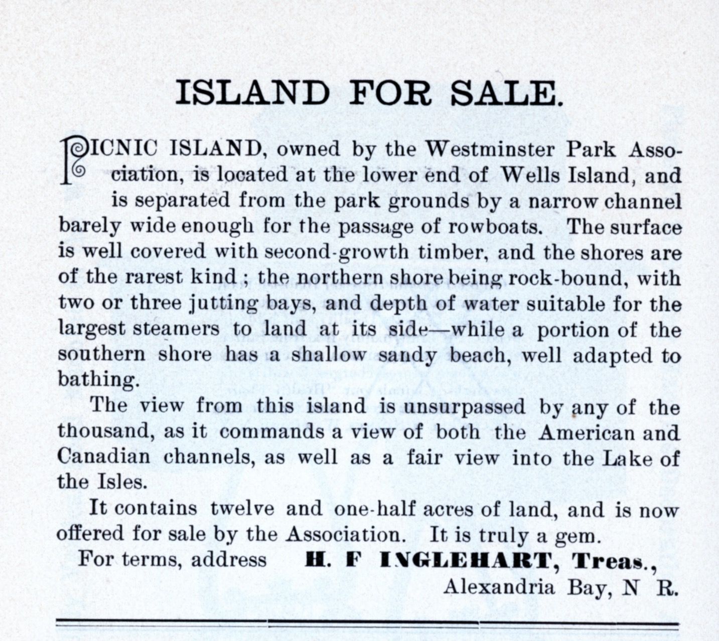
In 1887, we see the Westminster Park Association Trustees offering Picnic Island for sale. This ad appeared in their 1887 tourist brochure.
In 1888, John J. Flanagan died unexpectedly at age 47. The Presidency of the Anglers' Association was assumed by W. W. Byington of Albany. The Anglers continued efforts to curtail net fishing, which was believed to be decimating game fish populations. Both American and Canadian conservation groups discussed the establishment of a fishing season with beginning and end dates, the institution of fishing licenses, hiring game wardens to enforce laws, and other ideas designed to protect the native game fish population. But another issue was on the minds of these conservationists.
In those days, local guides would take guests out for a day of fishing. The custom was to end the fishing excursion with a shore dinner. These picnic suppers were held on various vacant island properties. Private property owners began to object to these impromptu events on their land. Concerns included invasion of private property, the danger of campfires, and the refuse left behind. The Anglers’ Association discussed the idea of the initiation of an International Park of Canadian and American islands that would provide public lands for such events. Uniform rules between two nations were not easily hammered-out, but in 1896, the Legislature of New York enacted this law: “An Act for the establishment of a State Reservation upon and along the Saint Lawrence River in the State of New York.” (Chapter 802 of the Laws of 1896). This resolution led to the establishment of “small pieces of land at convenient places to be owned by the state and to be kept free for the public use, and to provide boat landings, camping and picnic sites.”
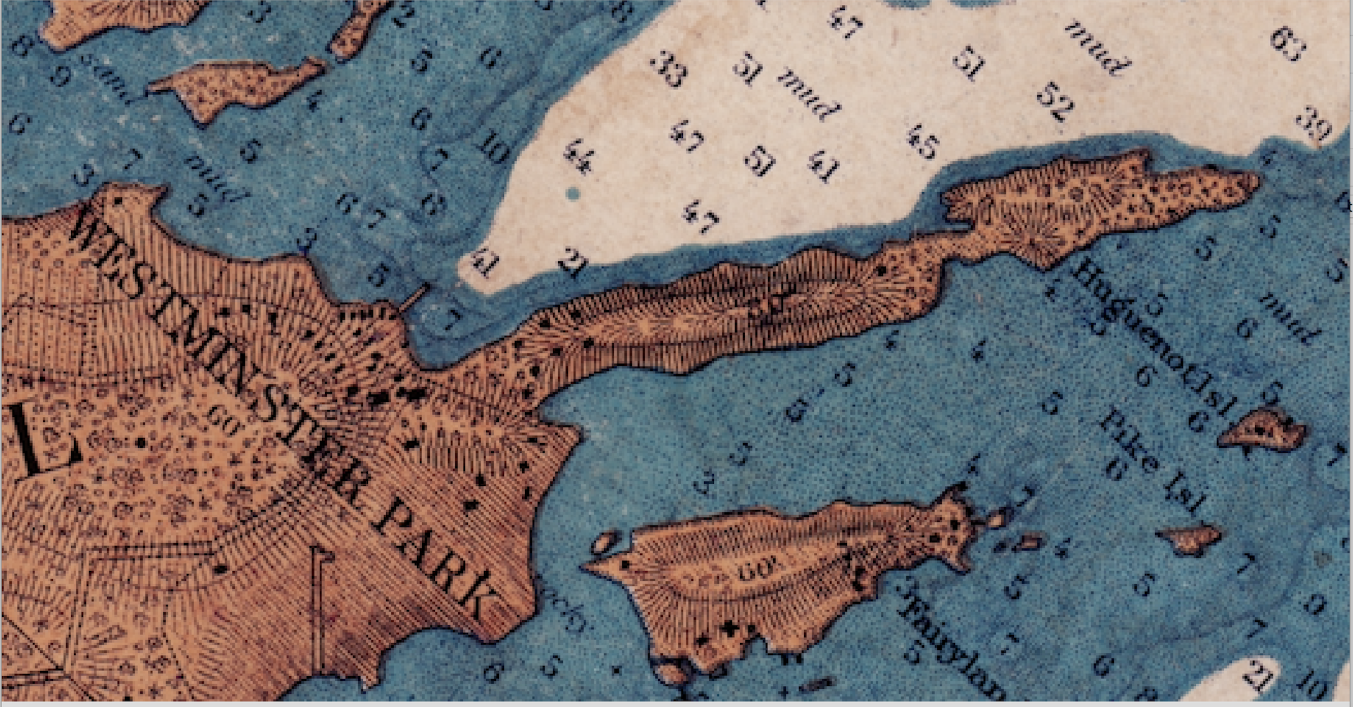
In 1897, the NYS Legislature appropriated $30,000. for the purchase of nine islands or points of land. Additionally, beyond the land purchase, the money was to be used for “building wharves, piers, and necessary buildings on the lands so acquired, and for otherwise maintaining and improving the lands of the state within such reservation.” Two properties in Saint Lawrence County and seven properties in Jefferson County were purchased. The first two islands purchased were Mary Island and Cedar Island. The purchase price of Mary Island was $5,000.The date was December 1897. In 1898, an additional $10,000 was allocated by New York State for further improvements.
Within a short time, New York State built a pavilion, with picnic tables and benches, on Mary Island. Stone fireplaces with iron grates were constructed to reduce the risk of fire. A large dock to accommodate a steamer and a smaller dock for the skiffs of fishing guides were built. This purchase was the beginnings of the New York State Park system. Now land was available to the public for recreational purposes. One early report to the State announced these parks were, “owned collectively by every citizen of the state.”
Decades later as youngsters, my generation would hike up to Mary Island, dash across the neighbor’s yard, (Yes! the Westminster Park side of the canal is private property!!), ford the canal, and spend a glorious day swimming and cliff diving. Now in 2019, on our most recent boat ride, I noticed a green rope snaking down the cliff. Someone is still enjoying that pursuit!
Wish you could visit Mary Island? Those with internet access can take a virtual tour at www.parks.ny.gov. It is a treat to visit these views of a summer’s day on the River when we are snowed-in or far away from the islands!
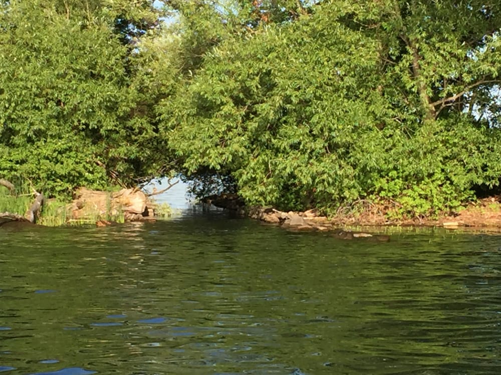
So now, we will take a look at the canal. There is much confusion about the Mary Island canal. Some mistake it for Willow Channel (the Ferry Slip). Adding to that confusion is George Boldt’s 1902 dream to build a canal from his boathouse through Mud Creek and on to the Lake of the Isles. (Boldt’s canal was begun, but never completed.)
We do know that the Mary Island shore was owned by The State Reservation, and later the NYS Office of Parks, Recreation, and Historic Preservation. The Westminster shore is private property and is owned by the cottage owners adjacent to the canal. Over the years, some of those landowners have untaken efforts to shore up the banks of the canal. In 1914, Joseph B. Peno, who owned a cottage called “Birkenshaw”, joined with the Westminster Park Association with plans to make improvements to the canal. In August of 1915, the “Thousand Islands Sun” published an article calling for 200 men to help with “the blasting, excavating, and walling” of the Mary Island Canal. The article noted that that year was a “low water year” and the perfect time for such work. Mr. Peno was chosen to oversee the project. Monetary contributions from the public could be left at the T. I. Sun office, or with Fred Inglehart of the WP Hotel, or D. Griffin of Rockport, Ontario. The plan called for removing heavy rocks which were obstructing the waterway. Peno called upon Canadian neighbor, Rob Hunt, who as an “expert” with dynamite, to blast out the boulders. (Rob was a colorful River folk hero. Many legends have been told in the islands about Rob’s escapades. It was said that he used the Mary Island Canal to escape game wardens who were chasing him for exceeding game limits.
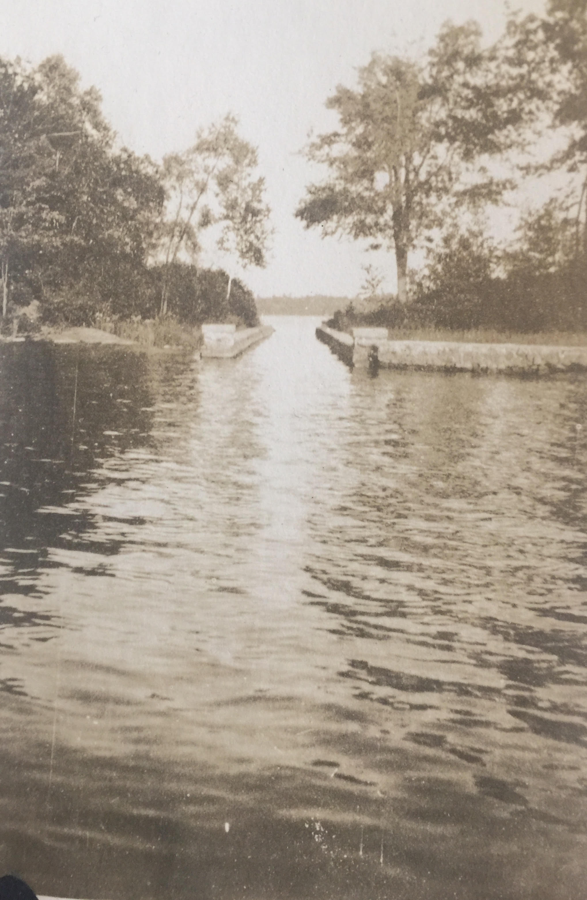
By 1922 we see from family photo albums that the Mary Island Canal was in fine form with defined stone walls. Nevertheless, it was never wide enough or deep enough to handle more than small craft.
Over the years, other crews have attempted to maintain this tiny waterway. There was such an effort in the 1950’s. I have read reports that the Westminster landowner worked on the canal in the 1980’s. Any recent reports?
It should be noted that in 2019 the canal is overgrown with low-hanging trees and shrubs. The elements or the trespassers sometimes cause rocks to fall into the canal and any navigation attempt is AT YOUR OWN RISK!
There were a number of canals in Westminster Park from the earliest days. The Mary Island Canal is the one that is most obvious to us today. Other waterways have suffered from the elements and modern innovations. The markers of these canals are mostly gone. If you look at old postcards, or photos of Westminster canals, look for stone side walls. The Mary Island Canal was designed for skiffs and small craft. If you see a double-decker ferry boat coming through the trees, it is most likely not the Mary Island Canal, it is likely Willow Channel. We’ll write about that another time.
©Linda Twichell 2019