Editor's Note: The author, Jerry Knitis, has undertaken a mammoth research project and Thousandidlandslife.com is honoured to present his findings to date. Those of us who ply the mighty St. Lawrence through the Thousand Islands will recognize normal hazards such as navigating the many channels going west. With no channel markers, no navigation aids and crudely drawn charts, we salute these early mariners. Mr. Knitis, we thank you for sharing and we look forward to lots more information in the future.
Whaleboats of the River
During the 18th century, whaleboats were primarily used as workboats. Although they were not used for whaling on the River, they played a significant role during the French and Indian War, which took place from 1755 to 1760. These boats were used as boats of war during the conflict, and their historical significance can still be seen in the Thousand Islands region.
On September 8, 1760, General Jeffrey Amherst led the British Army in the final major siege of the French and Indian War. He encircled Montreal and the Governor of New France, Pierre-Rigaud de Vaudreuil, surrendered the city to avoid unnecessary loss of life. This event marked the end of Britain’s conquest of New France.
The next day, September 9th, General Amherst instructed Major Robert Rogers to prepare for a mission to take control of the western forts, starting with Fort Pontchartrain du Detroit. This gave Rogers the time he needed to gather the people Amherst had selected to accompany him.
On September 12th, Major Rogers received official orders from General Amherst to transport the terms of surrender and take command of the Western post. Rogers had little time to get underway, as it was late in the season. Nevertheless, he managed to carry out the mission successfully. The orders from Amherst to Rogers were as follows:
“By his Excellency Jeffery Amherst, Esq; Major General and Commander in Chief of all his Majesty 39’s forces in North America, &c. &c. &:c.
To Major Rogers, commanding His Majesty 39’s independent companies of Rangers &c. &c. &:c.
You will, upon receipt hereof, with Capt. Waite's and Capt. Hazen's companies of Rangers under your command, proceed in whaleboats from hence to Fort William- Augustus, taking along with you one Joseph Poupao, alias La Fleur, an inhabitant of Detroit, and Lieut. Brehme, Assistant Engineer.
From Fort William-Augustus you will continue your voyage by the north-shore to Niagara, where you will land your whale-boats, and transport them across the Carrying-place into Lake Erie, applying to Major Walters, or the officer commanding at Niagara, for any assistance you may want on that or any other occasion, …” [1]
The Journey Begins
On the crisp morning of September 13, 1760, Major Rogers and his expedition embarked on a momentous journey from Montreal towards Fort Pontchartrain du Detroit and other French western forts and posts. With winter approaching, time was running out to complete this mission. With General Amherst's orders, Rogers and his team began their journey by whaleboat from Montreal to Lake Ontario, then down the lake's north side to Fort Niagara. The expedition was made up of 200 people, including the people Amherst ordered, French guides, and laborers. The ranger companies formed the largest group of men, all equipped with their weapons and supplies, ready to face the challenges ahead.
Major Rogers' first major challenge was to navigate the whaleboats through the numerous rapids that dotted the route between Montreal and Fort William Augustus. The boats had to be rowed, carried, poled, towed, or portaged one hundred and fifteen miles up the River along the River coast until they reached Fort William Augustus, formerly known as Fort Levi, located directly above the Gallop rapids. The journey was arduous, and the team had to use all their skills and strength to overcome the rapids and keep the boats afloat. But they persevered, driven by their sense of duty and the knowledge that they were part of a mission that would shape the course of history.
About the Whaleboats
The 18th-century whaleboat served as a workboat with a design different from the 19th-century version.
“18th century boats were well rounded (blunt or not so streamlined) in the bow and had a long run (straight along the sides). This allowed for a very stable boat that “tracked” well in the water. They didn’t exactly resemble the boats of the later 19th century period such as the "Beetle Boat" or the "New Bedford Boat" which had sharply pointed ends and a long graceful flare and taper to the sides. The boats of the 18th century were workboats.” [2]
The whaleboats, commonly used during the colonial period, were a sight to behold. With a length of 27 feet and a width of 5.5 feet, they were designed to be both sturdy and nimble. The depth of the hull, measured from gunwale to keel, was 25 inches, which made them ideal for navigating up River and performing well on the Great Lakes.
Despite their impressive design, the whaleboats were not light. A typical 28-foot whaleboat weighed a massive 1,000 pounds when empty, not counting the weight of the crew or equipment. It was remarkable that the boats and gear could be dragged up River over numerous rapids without losing a man or damaging the boats.
Amherst had given Rogers 15 whaleboats and 200 people for his expedition. The boats were typically loaded with 10 to 14 men and their equipment. Based on this, I calculated that there would be 12 to 15 men per boat for this mission. With this number of potential rowers, the team could progress nonstop and achieve their goals.
The Thousand Islands Journey
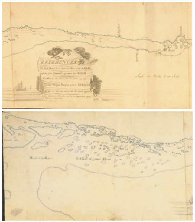
My research aims to identify Rogers's route during his expedition through the Lake of the Thousand Islands. It is uncertain whether Major Rogers possessed a map, although there is speculation that he did. His contingent included both Lieutenant Thomas Davies and Lieutenant Deitrich Brehm. Lieutenant Davies produced a map detailing the route from Montreal to the remains of Fort Frontenac (present-day Kingston, Ontario), while Lieutenant Brehm created a map from Frontenac to Fort Niagara (present-day Youngstown, New York). As Lieutenant Brehm was a cartographer, it is plausible that he contributed his expertise to Lieutenant Davies and both officers were likely involved in the creation of the "DRAUGHT OF THE RIVER ST. LAWRENCE FROM LAKE ONTARIO TO MONTREAL." However, decoding the "DRAUGHT" presents a challenge. Two map panels are available for viewing on the William L. Clements Library website at the University of Michigan. Additionally, excerpts from Major Rogers' journals have been provided to reference his journey through the Thousand Islands.
The journey through the rapids would have been difficult with the boats they used. However, Major Rogers did not mention it in his journal. Later in his career, he referred to the trip upriver through the rapids as a source of exhaustion for his men.
It took Rogers and his expedition six days to travel 155 miles to reach Fort William-Augustus, the former French fort, Fort Levi on Isle Royale. They still needed to cover a significant distance to reach Fort Detroit. The entries in Rogers' journal until reaching the ruins at Fort Frontenac are as follows:
In the evening of the 19th we came to the Isle de Gallettes, and spent the 20th repairing our whale-boats, which had received some damage in ascending the rifts.
This morning I sent off ten sick Rangers to Albany, by way of Oswego, recommending them to the care of Col. Fitch, commanding at Oswego, who was to give them suitable directions.
We left Isle de Gallettes on the 21st; about twelve o'clock, the wind being unfavourable, we passed Oswegachi, and encamped but three miles above it on the northern shore.
On the 22d we continued our course up the River, the wind blowing fresh at south, and halted in the evening at the narrow passes near the islands; but, upon the wind's abating at midnight, we embarked and rowed the remainder of that night, and the whole day following, till we came to the place where formerly stood the old Fort of Frontinac, where found some Indian hunters from Oswegachi. We were detained here all the next day by the tempestuousness of the weather, which was very windy, attended with snow and rain; we, however, improved the time in taking a plan of the old fort, situated at the bottom of a fine safe harbour.” [3]
The excerpt above is taken from Rogers' journal and describes the expedition's journey from the last rift (Gallop Rapids) to Isle de Gallettes (Fort William-Augustus; Chimney Island).
On September 20th, Rogers and his men spent a day at the fort. During this time, they repaired damaged whaleboats, stocked up on provisions, and attended to the needs of their sick or injured men. Rogers sent ten men he deemed unfit for the journey to Albany through Fort Oswego.
On September 21st, at approximately midday, Major Rogers began his journey up the River again. The expedition passed by Oswegachi [4] , a place of significance for the British army, who renamed the remains of Fort La Presentation, Fort Oswegatchi, after their victory in the Battle of the Thousand Islands. After traveling about 7.5 miles from Fort William-Augustus, or roughly three miles up River from Oswegachi, the expedition set up camp for the evening. Today, the exact spot where Major Rogers and his team camped is known as Blakeys Point in Ontario, Canada.
The slow progress was due to the strong wind and waves. This section of the River is straight and open, without any islands that could reduce the impact of the wind or provide shelter from the waves.
On September 22nd, Major Rogers continued up River on his mission, starting at daybreak as usual. This was the norm for Major Rogers when on a military expedition. In his journal, he noted that the wind was blowing “fresh at the south”. In the 18th century, a standardized measure of sea conditions was non-existent, leading to subjective descriptions from naval officers making weather observations. What one person deemed a “gentle breeze” could be classified as a “strong breeze” by another. Nevertheless, the whaleboats were capable of navigating these conditions. Based on my calculations, Major Rogers spent approximately 13 hours on the water, traveling upstream against the wind, maintaining an estimated boat speed of around two miles per hour.
As they made their way up River from Blakeys Point, Ontario, passing the remains of the French shipyard at Point au Baril, they eventually approached a cluster of islands about 10 miles away. These islands are now known as the Brockville Narrows, but in 1760, neither the channel nor the islands were named.
During the twilight hours, the expedition established their encampment at a location known as Petit Detroit, which is also referred to as Tar Island Narrows, present day. This location was widely recognized and acknowledged in the 18th century. However, upon examining the Davies map, it appears the route led them between Tar Island and Grenadier Island.
The author believes this to be an accurate representation of the route taken by the expedition. This suggests that Major Rogers and his team may have established their campsite at Grenadier Island, which is presently home to a country club near Alexandria Bay. The expedition had covered a distance of approximately 26 to 27 miles.
At midnight, the wind subsided, and Major Rogers ordered the boats to be shoved into the water. The expedition resumed its journey up River during nighttime. I believe that the night was clear and moonlit. This would allow Major Rogers to follow an undocumented route and maintain better boat speed. The expedition was going through the Thousand Islands during the dark of night. At first light, the expedition was out in Baie Corbeau (Halsteads Bay), heading toward Isle au Citron (Gordon Island).
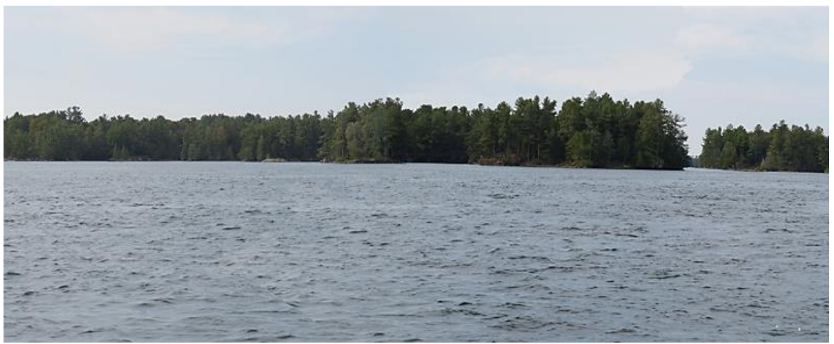
Isle au Citron (Gordon Island)
As the expedition passed Isle au Citron, on their starboard side. It is unclear if they landed on the island or passed it very close.

As the expedition continued toward Frontenac, they rowed past a River on their starboard side (Gananoque River). They were heading for an unnamed point (Lindsay Point, west of Gananoque, ON) and the Batteau Channel, which would take them to the ruins of Fort Frontenac. A distance of 32.06 miles. They were on the water for about 18 to 20 hours. The minimum boat speed would have been 1-3/4 miles per hour. If conditions were favorable, with minimal wind and a seasoned crew, which the rangers were, they could easily get over 3 miles per hour for the boat speed. They would not have to stop for rest, as they had enough men in each boat to relieve the tired oarsmen.
Capturing history
I have been investigating and trying to locate the route that Major Rogers followed through the Thousand Islands. My curiosity, Major Rogers' journal, and a map drawn by Lt. Davies inspired me.
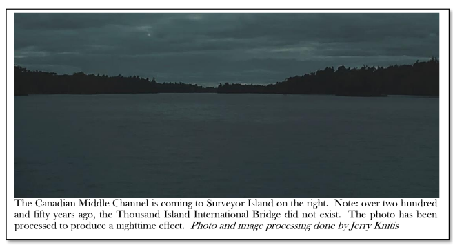
My goal is to photograph the route as closely as possible and image-process the photos, removing all man-made objects from the scene. Little is known about this event, which occurred over 250 years ago.
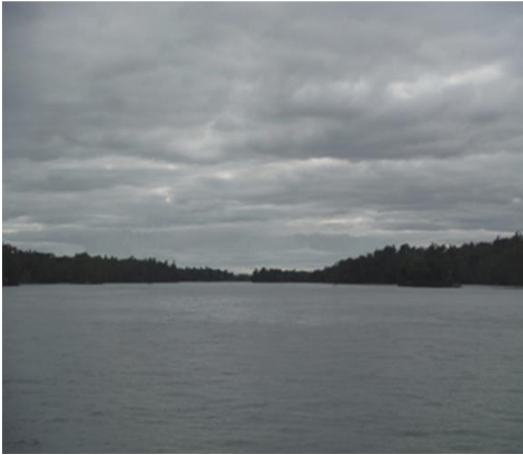
Therefore, members of that expedition may have observed the following image when approaching the "Lost Channel" area in the Canadian Middle Channel.
More to discover
After years of dedicated research and exploration, I have successfully charted the most plausible path that Major Rogers' expedition might have taken through the Thousand Islands. It has been a fascinating and challenging quest, but the satisfaction of uncovering new information and connecting the dots has made it all worthwhile. I am excited to share my findings with others who share my passion for history and adventure.
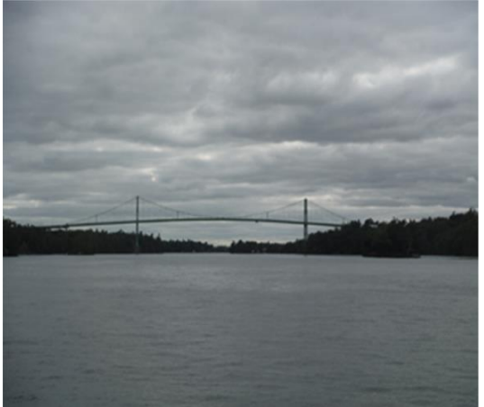
Capturing the final photograph was no easy feat. It required combining three separate images into one seamless composition and meticulously removing any traces of man-made objects that could potentially detract from the scene's natural beauty. This involved removing the towering Thousand Islands Bridge, several buildings, docks, and a tower. The result is a stunning photograph showcasing the raw, unadulterated beauty of the surrounding landscape.
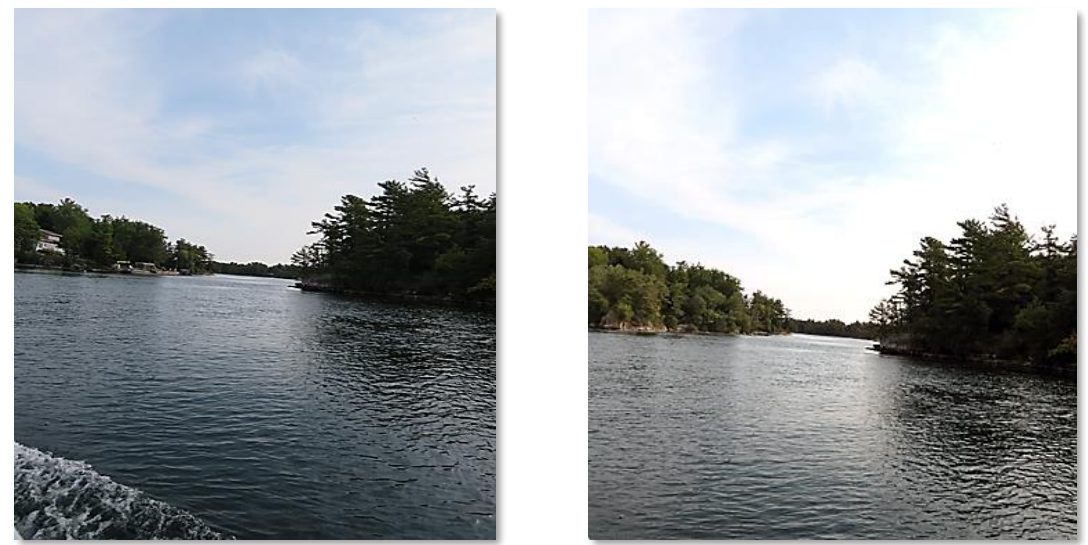
This photo was image processed and comprises two images sewed together and color balanced. It would have been nighttime when Major Rogers’ expedition reached this point. "Could you please tell me where the location is?"
End Notes
[1] JOURNALS OF MAJOR ROBERT ROGERS Printed for the author [Robert Rogers], and sold by J. Millan, Bookseller, near Whitehall London MDCCLXV: Page 197
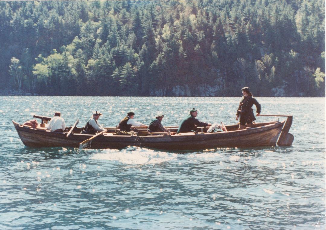
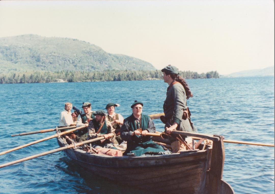
[2] Warren Stevens, a historian, researched and built a replica of the boat that Major Rogers and his Rangers used for their expeditions. The boat is an exact copy of the original vessel, and Warren invested a lot of time and effort into making it as accurate as possible. His work is impressive and deserves recognition.
[3] JOURNALS OF MAJOR ROBERT ROGERS pages. 201 & 202
[4] The correct spelling for the site is Oswegatchie. However, I am using the spelling found in Rogers’ journal and possibly how the British spelled it in 1760.
[5] The Beaufort Wind Scale is one of the first scales used to estimate wind speeds and their effects. It was devised in 1805, 45 years after Rogers’ journey, but Admiral Sir Francis Beaufort created the scale and could have used terms commonly used for nautical weather.
References
Hardcopy format
• The Journals of Jeffery Amherst, 1757-1763 Volume 1: The Daily and Personal Journals Edited by Robert J. Andrews; Michigan State University Press East Lansing, Michigan Hardcover Copyright: 2015
• Stevens, Warren “Whaleboats … The Backbone of Rogers’ Rangers” A paper written by Mr. Stevens about whaleboats used by the British during the French and Indian War. [9-page research paper]
• Historian Warren Stevens meticulously researched and constructed a faithful replica of the boat Major Rogers and his Rangers utilized during their expeditions. Mr. Stevens dedicated significant time and effort to ensure the replica's accuracy, and his commendable work merits acknowledgment. His invaluable contributions were pivotal to the feasibility of this project.
• Additionally, Mr. Stevens graciously provided the author with a series of photographs showcasing the vessel in action on Lake George.
• Todish, Timothy and illustrated by Zaboly, Gary S. THE ANNOTATED AND ILLUSTRATED JOURNALS OF MAJOR ROBERT ROGERS Published by Purple Mountain Press, LTD. 100 Main Street, P.O. Box 309 Fleischman’s New York 12430; First Edition Paperback Copyright: 2002.,
• Todish, Timothy and illustrated by Zaboly, Gary S. FRENCH AND INDIAN WAR VOLUME ONE TO DISTRESS THE FRENCH AND THEIR ALLIES ROGERS’ RANGERS 1755-1763 Published by Black Dome Press Corp. PO Box 64 Catskill, New York 12414; first edition paperback Copyright: 2023 ISBN: 979-89856921-3-6
• Zaboly, Gary Stephan A TRUE RANGER: THE LIFE AND MANY WARS OF MAJOR ROBERT ROGERS published byRoyal Blockhouse LLC, Garden City Park New York 2004
Electronic form
Rogers, Robert JOURNALS OF MAJOR ROBERT ROGERS London; Printed for the AUTHOR, and sold by J. MILI.AN, Bookseller, near Whitehall MDCCLXV [PDF format]
Maps/Charts
“DRAUGHT OF THE RIVER ST. LAWRENCE FROM LAKE ONTARIO TO MONTREAL.” 1760, Drawing by Lt. Thomas
Davies Royal Artillery, University of Michigan Library Digital William L. Clements Library Ann Arbor, Michigan.
Image Bank
URL: 0 URL Date: 13 May 2020
Posted in: Volume 19, Issue 6, June 2024, History, People, Places, Current
Please click here if you are unable to post your comment.